Project
What is the Deschutes Estuary?
Historically, what is currently known as Capitol Lake was part of the Deschutes Estuary, where freshwater from the Deschutes River would mix with saltwater from Budd Inlet over expansive tideflats. The Deschutes Estuary has long-standing cultural and spiritual significance to local Tribes, particularly the Squaxin Island Tribe. The Squaxin Island Tribe considers the people and land of Deschutes Estuary as Steh-Chass.
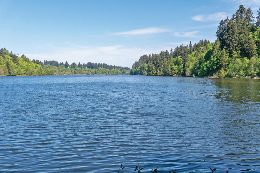
Between 1949 and 1951, a dam was constructed at 5th Avenue. Without the tidal exchange, the area was transformed into a freshwater lake, fed primarily by the Deschutes River.
What problem is this Restoration project seeking to resolve?
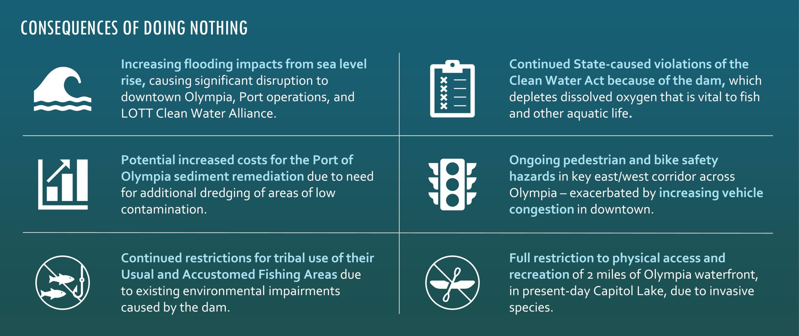
An estimated 35,000 cubic yards of sediment are transported by the Deschutes River (and Percival Creek) into the Capitol Lake Basin each year, shallowing the lake and resulting in conditions that are visibly altered. Since construction of the 5th Avenue Dam, sediment accumulation has reached up to 13 feet thick in some areas. Water quality monitoring began in the 1970s in response to excessive growth of aquatic plants, dense algal mats, and reduced water clarity, which are caused by high nutrient levels in Capitol Lake. In 1985, the Capitol Lake swimming beach, operated by the City of Olympia, was formally closed because of high bacteria levels, following years of intermittent closures due to water quality conditions near the swimming area, including lack of water clarity.
Beginning in the late 1980s, management strategies were implemented to address aquatic invasive species. There are now more than a dozen different plant and animal aquatic invasive species in Capitol Lake. In 2009, the presence of the invasive New Zealand mudsnail resulted in official closure of the waterbody to all public uses. This includes restricted access by the Squaxin Island Tribe to their usual and accustomed fishing grounds and stations.
A long-term management approach is needed to address these environmental conditions that persist today. Estuary restoration was selected as the long-term management approach in 2022.
What Are the Benefits of this Estuary Restoration?
Restores the natural transition between freshwater and saltwater favorable to salmon and advances recovery for Orca and salmon
Establishes over 100 acres of salt marsh habitat and 100 acres of estuarine habitat, which is rare and preferred forage and rearing habitat for salmon
Increases climate resiliency across the City of Olympia by reducing maximum flood elevations by up to 1 foot compared to with the dam in place
Addresses chronic water quality violations by improving dissolved oxygen conditions in Budd Inlet, which is important for fish and aquatic life
Makes significant progress toward restoring a landscape that has cultural and spiritual significance to the Squaxin Island Tribe
Results in greater economic benefit to downtown Olympia through increased development with attractive and accessible estuary design
Potentially reduces cost of cleanup led by the Port of Olympia by depositing good-quality sediment over areas of low contamination downstream
Increases carbon sequestration through restoration of salt marsh habitat, which sequesters more than the existing freshwater habitat
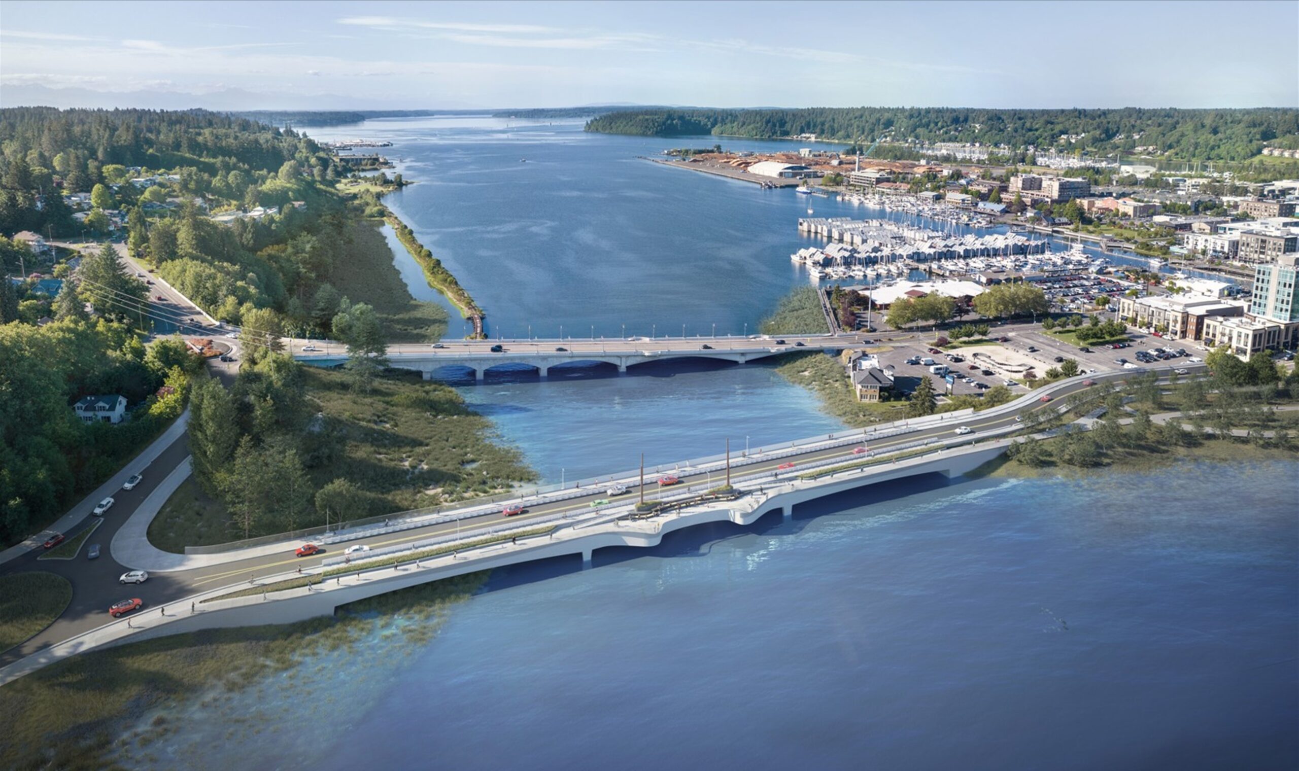
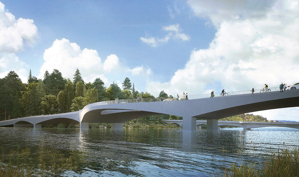
Constructs a new 5th Avenue Bridge with separated vehicle, bike, and pedestrian lanes and increases non-vehicular mobility in the corridor
Avoids increased regulatory burden and associated costs for LOTT Clean Water Alliance and other treatment plants and replaces stormwater outfalls
Eradicates more than 10 known aquatic invasive species in the waterbody and installs decontamination stations
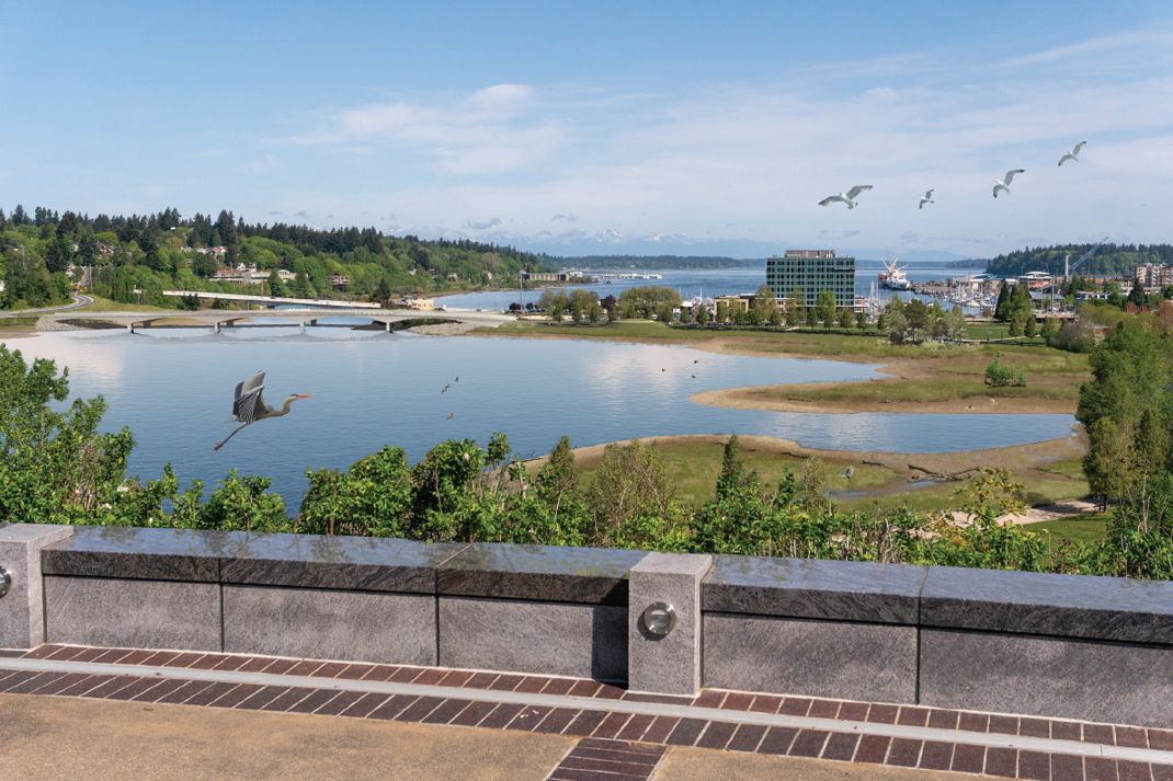
Creates vibrant and expansive shoreline habitat, restores fishing, and creates public access to the shoreline
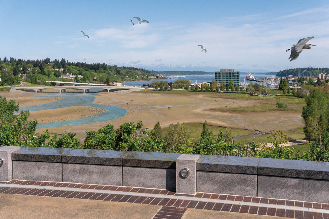
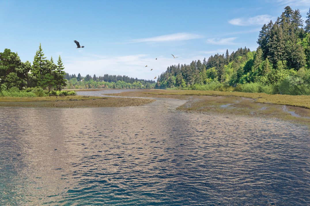
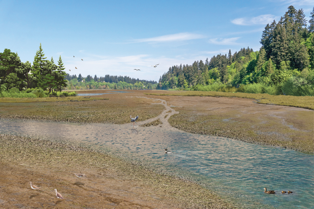
How will the estuary be restored?
The 5th Avenue Dam will be removed to reintroduce tidal flows to the project area. This will restore estuarine conditions where saltwater from Budd Inlet will mix with freshwater from the Deschutes River. Estuarine habitat is one of the scarcest and most valuable habitat types in Puget Sound. Habitat reestablished by dam removal will benefit migratory fish resident to the Deschutes River watershed and south Puget Sound fish populations that depend on estuarine habitat for juvenile rearing, foraging, and outmigration, including Coho and Chinook salmon.
If funding is available, recreation will be enhanced with new boardwalks in addition to the maintained loop around the North Basin. A fishing pier will be restored and water access points will be incorporated into the design. Recurring maintenance dredging will occur in navigational areas of West Bay to support recreational boating, Port operations, and a vibrant waterfront. Funding for that dredging after construction will be provided by the regional partners, as outlined in a legally binding Interlocal Agreement.
Conceptual Overview
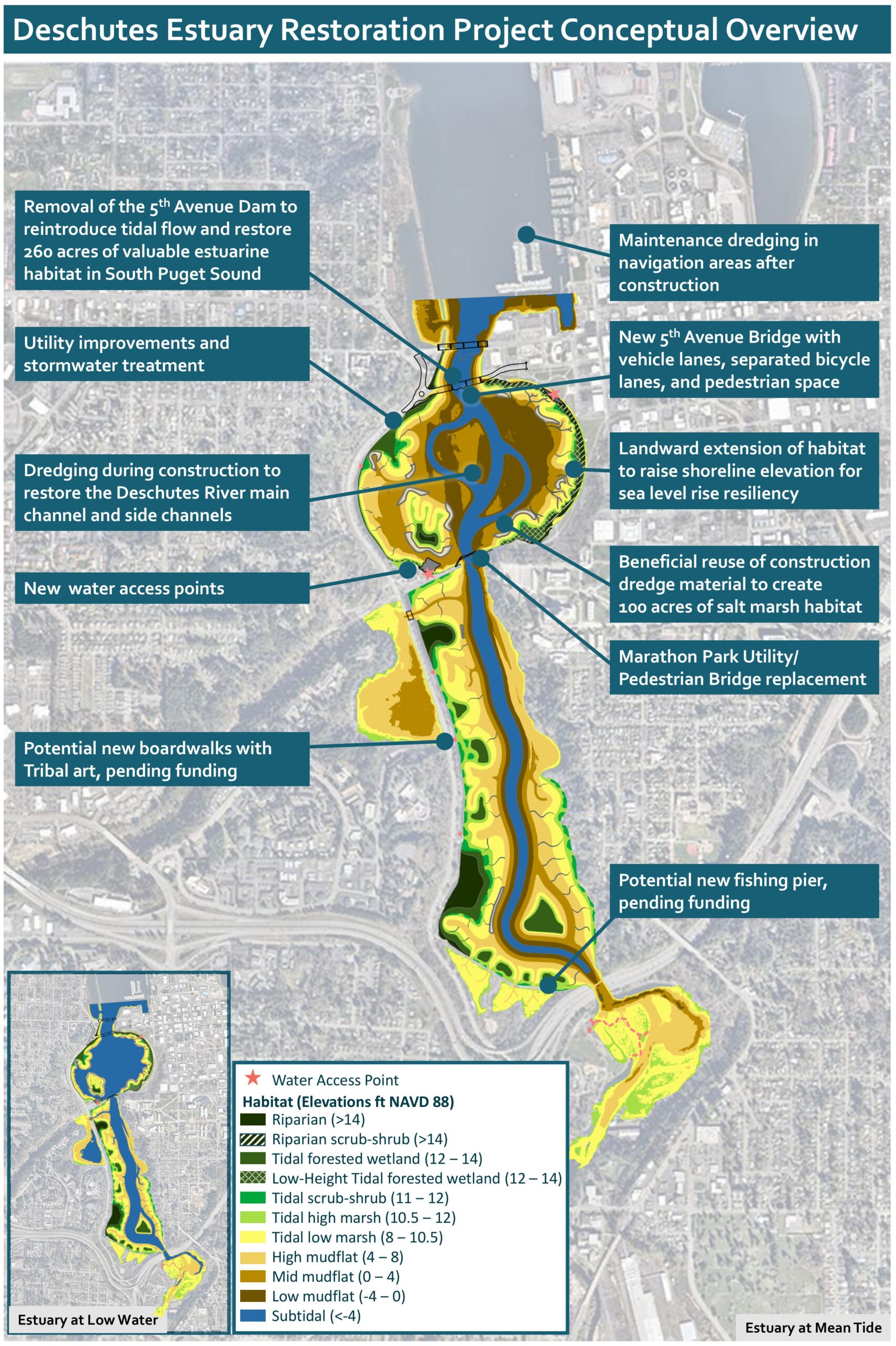
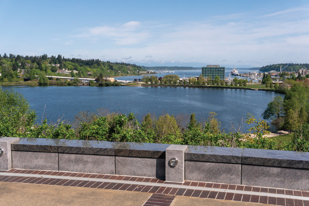
Project Area

The project area extends from the base of Tumwater Falls, in Tumwater, to 5th Avenue, in Olympia.
Visual Simulations as of August 2024